
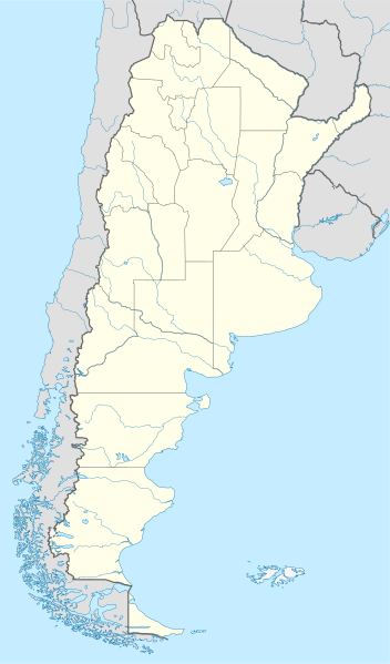
Arkivo:Argentina location map.svg

Grandezo di la previdado PNG de ica arkivo SVG: 352 x 599 pixels. Altra qualeso, en pixel-i: 141 x 240 pixels | 282 x 480 pixels | 451 x 768 pixels | 602 x 1 024 pixels | 1 204 x 2 048 pixels | 1 418 x 2 412 pixels.
Arkivo originala (arkivo SVG, nominale 1 418 x 2 412 "pixels", kun 1,03 MB)
Titulo
.svg)
.svg)

|
This map has been made or improved in the German Kartenwerkstatt (Map Lab). You can propose maps to improve as well.
|
Licencizo
Me, la proprietero dil autoroyuri pri ica verko, per to publikigos ol segun la sequanta yurizi:

|
On darfas kopiigar, distributar ed/od altrigar ica dokumento segun la kondicioni di GNU Free Documentation License, quale esas mencionita en la versiono 1.2 od en irga plu posa versiono, qua esas publikigita da Free Software Foundation; En la dokumento ne darfas esas ne-altrigita parti ed olu ne darfas esar kom texto di frontala o dopala pagino di libro o GNU Free Documentation License. |
Ica arkivo liberigesas sub permiso Creative Commons Attribution-Share Alike 3.0 Unported.
- Vu povas:
- partigar – kopiar, distributar e transsendar la verko
- Mixar – adaptar l'arkivo
- Segun la sequanta kondicioni:
- Atribuo – Vu mustas referar l'artiklo o verko segun la formo definita dal autoro o dal proprietero dil autoroyuro, ed informar se modifikuri facesis. Vu mustas facar to per justa formo, ma ne insinuar ke l'autoro konfidis ol a vu, od aprobis vua uzo dil artiklo.
- partigar identa ('share alike') – Se vu modifikos, transformos od augmentos ica verko, vu mustos distributar la rezulto segun la sama, o simila licenco, quale l'originalo.
Selektez l'yurizo quon vu preferas.
Historio dil arkivo
Kliktez sur la dato/horo por vidar arkivo quale ol aparis ye ta tempo.
| Dato/Horo | Miniaturo | Dimensioni | Uzero | Komento | |
|---|---|---|---|---|---|
| aktuala | 15:26, 11 di agosto. 2022 | | 1 418 × 2 412 (1,03 MB) | Janitoalevic | Reverted to version as of 02:18, 25 May 2021 (UTC) |
| 00:27, 9 may. 2022 |  | 1 418 × 2 412 (1,51 MB) | Buttons0603 | Reverted to version as of 20:33, 29 January 2021 (UTC) see below | |
| 02:18, 25 may. 2021 |  | 1 418 × 2 412 (1,03 MB) | MinervaAustral | Reverted to version as of 03:37, 24 November 2018 (UTC) | |
| 20:33, 29 jan. 2021 |  | 1 418 × 2 412 (1,51 MB) | Buttons0603 | Reverted to version as of 13:13, 23 November 2018 (UTC) There is already a version with the Falklands in white at File:Argentina location map (+Falkland).svg for when such a map is needed. | |
| 03:37, 24 nov. 2018 |  | 1 418 × 2 412 (1,03 MB) | Cacen Gymraeg | Reverted to version as of 01:43, 6 November 2017 (UTC). Added claim territories (neutral point of view) | |
| 13:13, 23 nov. 2018 |  | 1 418 × 2 412 (1,51 MB) | Mr. James Dimsey | Reverted to version as of 23:25, 9 October 2015 (UTC) | |
| 01:43, 6 nov. 2017 |  | 1 418 × 2 412 (1,03 MB) | Janitoalevic | Added Fontana and Plata Lake. | |
| 01:37, 6 nov. 2017 |  | 1 418 × 2 412 (1,02 MB) | Janitoalevic | Fixed provincial and international borders. | |
| 21:36, 25 mar. 2016 |  | 1 418 × 2 412 (997 KB) | Janitoalevic | Added all the Disputed Territories | |
| 19:00, 21 mar. 2016 |  | 1 418 × 2 412 (994 KB) | Gustavo Girardelli | Detalles. |
.svg)
Ligilo al imajo
Ca pagini ligas al imajo:
Uzado en altra Wiki
La sequanta Wiki anke uzas ica arkivo:
- Uzado en af.wikipedia.org
- Comodoro Rivadavia
- Mar del Plata
- Bariloche
- La Plata
- Villa General Belgrano
- FIFA Sokker-Wêreldbekertoernooi in 1978
- Balcarce
- Sarmiento
- Sjabloon:Liggingkaart Argentinië
- Monserrat, Buenos Aires
- Aconcagua
- Ojos del Salado
- Los Toldos
- Coloradorivier (Argentinië)
- Rawson
- Ministro Pistarini Internasionale Lughawe
- Uzado en an.wikipedia.org
- Uzado en ar.wikipedia.org
- Uzado en ast.wikipedia.org
- Buenos Aires
- Abbott
- Agote (Buenos Aires)
- La Plata
- Partido de La Plata
- Abasto (La Plata)
- Ángel Etcheverry
- Arturo Seguí
- City Bell
- Joaquín Gorina
- José Hernández (Buenos Aires)
- Manuel B. Gonnet
- Ringuelet
- Tolosa (Buenos Aires)
- Villa Elvira
- El Peligro (La Plata)
- San Carlos (Buenos Aires)
- Ríu de la Plata
- Mendoza (Arxentina)
- Costa de Reyes
- Santa Cruz (Catamarca)
- Las Tejas
Videz altra uzadi por ica artiklo.