
Arkivo:India in 250 BCE Joppen.jpg
Grandeso de ica previdado: 418 x 600 pixels. Altra qualeso, en pixel-i: 167 x 240 pixels | 334 x 480 pixels | 535 x 768 pixels | 714 x 1 024 pixels | 1 428 x 2 048 pixels | 2 670 x 3 830 pixels.
Arkivo originala (2 670 × 3 830 pixel-i, grandeso dil arkivo: 2,57 MB, MIME type: image/jpeg)
Titulo
| Deskripto | |
| Dato | |
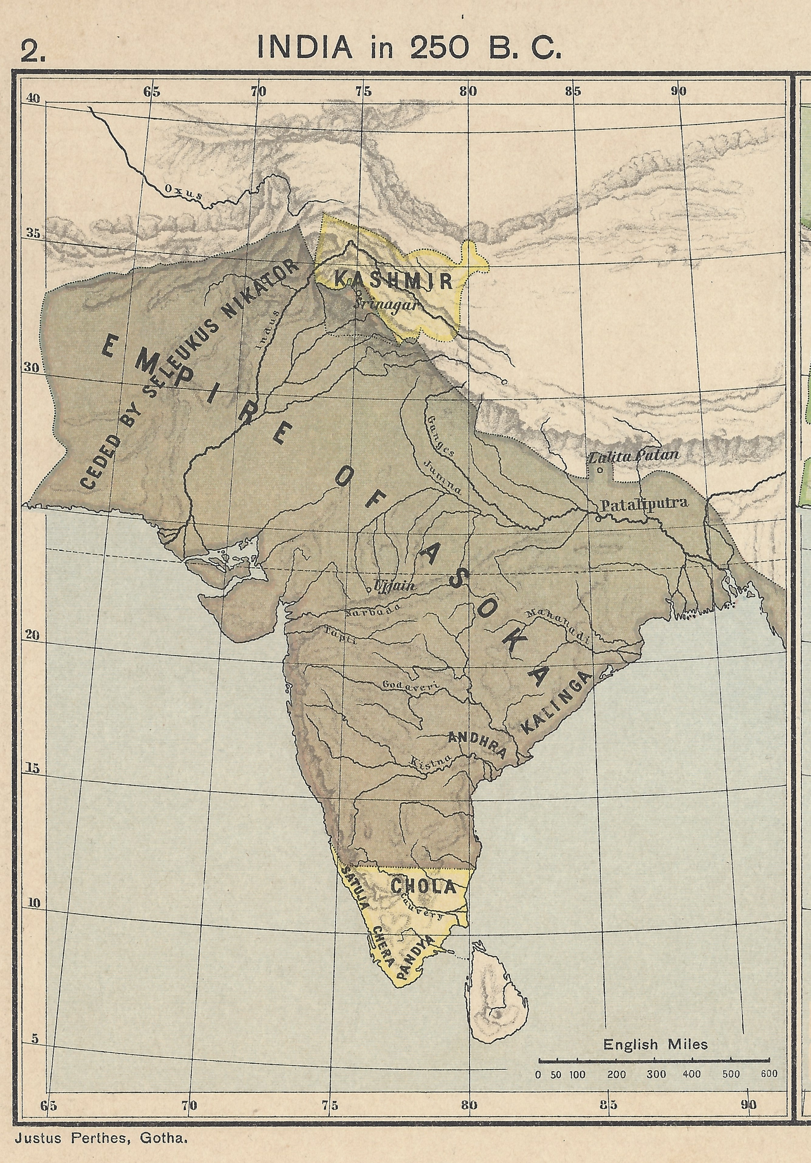
| Fonto | From a personal copy of A Historical Atlas of India by Charles Joppen SJ, London: Longman Greens, 1907 Fowler&fowler (diskutez) 20:48, 20 August 2019 (UTC) |
| Autoro | Justus Perthes, Gotha, 1907 |
Licencizo
|
Tiu ĉi verko estas publika havaĵo en tiuj landoj, kies kopirajtado validas por longo de vivo plus 70 jaroj aŭ malpli. This work is in the public domain in the United States because it was published (or registered with the U.S. Copyright Office) before January 1, 1929. | |
| Questo file è stato riconosciuto come libero da restrizioni di cui si abbia contezza ai sensi della normativa sul diritto d'autore, inclusi tutti i diritti annessi e connessi. | |
Historio dil arkivo
Kliktez sur la dato/horo por vidar arkivo quale ol aparis ye ta tempo.
| Dato/Horo | Miniaturo | Dimensioni | Uzero | Komento | |
|---|---|---|---|---|---|
| aktuala | 20:39, 20 di agosto. 2019 | | 2 670 × 3 830 (2,57 MB) | Fowler&fowler | User created page with UploadWizard |
Ligilo al imajo
Ca pagini ligas al imajo:
Uzado en altra Wiki
La sequanta Wiki anke uzas ica arkivo:
- Uzado en ar.wikipedia.org
- Uzado en ckb.wikipedia.org
- Uzado en en.wikipedia.org
- Uzado en hy.wikipedia.org
- Uzado en ro.wikipedia.org