Arkivo:Kingdoms of Israel and Judah map 830.svg

Paĝenhavo ne ekzistas en aliaj lingvoj.
De Wikipedio

Arkivo originala(arkivo SVG, nominale 720 x 859 "pixels", kun 96 KB)

Igar ca imajo en .

Ca arkivo jacas en Wikimedia Commons, e povas uzesar en altra projeti. La deskriptado en lua pagino di deskriptado montresas adinfre.

Deskripto
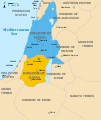
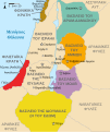
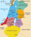
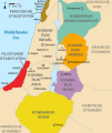
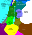
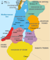
English: Approximate map showing the Kingdoms of Israel (blue) and Judah (orange), ancient Southern Levant borders and ancient cities such as Urmomium and Jerash. The map shows the region in the 9th century BCE.
Italiano: Il regno di Giuda e quello di Israele nell'età del ferro (VIII secolo a.C.).
日本語: 紀元前830年代のユダ王国(黄色).
Русский: Царство Иудея 927 по 526 гг. до н. э. Отсюда иудеи были сосланы завоевателями в Вавилонский регион.
Bahasa Indonesia: Peta kerajaan-kerajaan di daerah tersebut pada abad 9 SM.
Simple English: The northern Kingdom of Israel and the Kingdom of Judah to the south.
Srpskohrvatski / српскохрватски: Karta Sjevernog i JUžnog Kraljevstva. Samarija je bila glavni grad Kraljevstva Izrael (plavo). 830-e pne.,.
Latviešu: Izraēlas un Jūdejas karalistes. Jūdejas karaliste (dzeltenā) ap 830. gadu p.m.ē.
Dato (UTC)
Fonto http://www.jewishvirtuallibrary.org/map-of-israel-and-judah-733-bce
Autoro
Altra versioni

[redaktar]

Color scheme 1
Color scheme 2
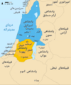
Israel and Judah colored
Just Israel and Judah
Me, la proprietero dil autoroyuri pri ica verko, per to publikigos ol segun la sequanta yurizi:
w:eo:Creative Commons
Atribuo partigar identa ('share alike')
Ica arkivo liberigesas sub permiso Creative Commons Attribution-Share Alike 3.0 Unported.
Vu povas:
  • partigar – kopiar, distributar e transsendar la verko
  • Mixar – adaptar l'arkivo
Segun la sequanta kondicioni:
  • Atribuo – Vu mustas referar l'artiklo o verko segun la formo definita dal autoro o dal proprietero dil autoroyuro, ed informar se modifikuri facesis. Vu mustas facar to per justa formo, ma ne insinuar ke l'autoro konfidis ol a vu, od aprobis vua uzo dil artiklo.
  • partigar identa ('share alike') – Se vu modifikos, transformos od augmentos ica verko, vu mustos distributar la rezulto segun la sama, o simila licenco, quale l'originalo.
GNU head On darfas kopiigar, distributar ed/od altrigar ica dokumento segun la kondicioni di GNU Free Documentation License, quale esas mencionita en la versiono 1.2 od en irga plu posa versiono, qua esas publikigita da Free Software Foundation; En la dokumento ne darfas esas ne-altrigita parti ed olu ne darfas esar kom texto di frontala o dopala pagino di libro o GNU Free Documentation License.
Selektez l'yurizo quon vu preferas.

Originala protokolo dum sendado dil arkivo

This image is a derivative work of the following images:

  • File:Oldtidens_Israel_&_Judea.svg licensed with Cc-by-sa-3.0, GFDL
    • 2010-01-30T16:10:36Z FinnWikiNo 726x868 (109641 Bytes) {{Information |Description={{en|1=Map showing the ancient levant borders and ancient cities such as [[Urmomium]] and [[Jerash]]. The map also shows the region in the 9th century BCE. Notice the coastal land of Philistia, from

Uploaded with derivativeFX

Titoloj

Adjuntez 1 lineo explikanta quo reprezentas ca arkivo

Kozi montrata en ca arkivo

montras Esperanto

sub kopirajto Esperanto

12 jul. 2010

MIME-tipo Esperanto

image/svg+xml

Historio dil arkivo

Kliktez sur la dato/horo por vidar arkivo quale ol aparis ye ta tempo.

Dato/HoroMiniaturoDimensioniUzeroKomento
aktuala14:12, 1 okt. 2021Imajeto di versiono ye 14:12, 1 okt. 2021720 × 859 (96 KB)SadopaulFile uploaded using svgtranslate tool (https://svgtranslate.toolforge.org/). Added translation for ko.
15:50, 10 feb. 2017Imajeto di versiono ye 15:50, 10 feb. 2017720 × 859 (80 KB)Malus Catulusremoved 'Sizu' - a weird artifact from the Norse original
23:48, 12 feb. 2011Imajeto di versiono ye 23:48, 12 feb. 2011720 × 859 (78 KB)Malus Catulus-
11:29, 13 jul. 2010Imajeto di versiono ye 11:29, 13 jul. 2010720 × 859 (79 KB)Malus CatulusFixed Judah color
10:51, 13 jul. 2010Imajeto di versiono ye 10:51, 13 jul. 2010720 × 859 (79 KB)Malus CatulusAdded colors for the two kingdoms and converted their text to path and arial
23:53, 12 jul. 2010Imajeto di versiono ye 23:53, 12 jul. 2010720 × 859 (62 KB)Malus CatulusShrinked down the borders
19:43, 12 jul. 2010Imajeto di versiono ye 19:43, 12 jul. 2010720 × 859 (62 KB)Malus Catulus{{Information |Description={{en|1=Map showing the ancient levant borders and ancient cities such as Urmomium and Jerash. The map also shows the region in the 9th century BCE. Notice the coastal land of Philistia, from which the name "Palestine

Ca pagini ligas al imajo:

Uzado en altra Wiki

La sequanta Wiki anke uzas ica arkivo:

Videz altra uzadi por ica artiklo.
Metadonaji