
Arkivo:Oxfordshire UK locator map 2010.svg

Grandezo di la previdado PNG de ica arkivo SVG: 494 x 600 pixels. Altra qualeso, en pixel-i: 198 x 240 pixels | 395 x 480 pixels | 633 x 768 pixels | 843 x 1 024 pixels | 1 687 x 2 048 pixels | 1 108 x 1 345 pixels.
Arkivo originala (arkivo SVG, nominale 1 108 x 1 345 "pixels", kun 302 KB)
Titulo
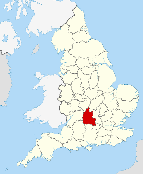
| Deskripto | Location of the ceremonial county of Oxfordshire within England. |
| Dato | |
| Fonto |
National Geospatial-Intelligence Agency
|
| Autoro | Nilfanion |
Licencizo
Me, la proprietero dil autoroyuri pri ica verko, per to publikigos ol segun la sequanta yurizi:
Ica arkivo liberigesas sub permiso Creative Commons Attribution-Share Alike 3.0 Unported.
- Vu povas:
- partigar – kopiar, distributar e transsendar la verko
- Mixar – adaptar l'arkivo
- Segun la sequanta kondicioni:
- Atribuo – Vu mustas referar l'artiklo o verko segun la formo definita dal autoro o dal proprietero dil autoroyuro, ed informar se modifikuri facesis. Vu mustas facar to per justa formo, ma ne insinuar ke l'autoro konfidis ol a vu, od aprobis vua uzo dil artiklo.
- partigar identa ('share alike') – Se vu modifikos, transformos od augmentos ica verko, vu mustos distributar la rezulto segun la sama, o simila licenco, quale l'originalo.

|
On darfas kopiigar, distributar ed/od altrigar ica dokumento segun la kondicioni di GNU Free Documentation License, quale esas mencionita en la versiono 1.2 od en irga plu posa versiono, qua esas publikigita da Free Software Foundation; En la dokumento ne darfas esas ne-altrigita parti ed olu ne darfas esar kom texto di frontala o dopala pagino di libro o GNU Free Documentation License. |
Selektez l'yurizo quon vu preferas.

|
This is one of the images forming part of the Valued image set: Locator maps of the Ceremonial counties of England on Wikimedia Commons. The image set has been assessed under the valued image set criteria and is considered the most valued set on Commons within the scope:
Locator maps of the Ceremonial counties of England
You can see its nomination at Commons:Valued image candidates/Locator maps of English ceremonial counties. |
Historio dil arkivo
Kliktez sur la dato/horo por vidar arkivo quale ol aparis ye ta tempo.
| Dato/Horo | Miniaturo | Dimensioni | Uzero | Komento | |
|---|---|---|---|---|---|
| aktuala | 22:25, 23 nov. 2010 | | 1 108 × 1 345 (302 KB) | Nilfanion | use ceremonial counties - corresponds with text of article better |
| 16:39, 23 nov. 2010 |  | 1 108 × 1 345 (332 KB) | Nilfanion | Fix coast - add Arran | |
| 00:47, 16 nov. 2010 |  | 1 108 × 1 345 (325 KB) | Nilfanion | thicker lines | |
| 00:44, 16 nov. 2010 |  | 1 108 × 1 345 (325 KB) | Nilfanion | {{Information |Description=Location of Oxfordshire within England, with the administrative counties shown. |Source=Ordnance Survey [https://www.ordnancesurvey.co.uk/opendatadownload/products.html OpenData]: *County |
Ligilo al imajo
Ca pagini ligas al imajo:
Uzado en altra Wiki
La sequanta Wiki anke uzas ica arkivo:
- Uzado en af.wikipedia.org
- Uzado en an.wikipedia.org
- Uzado en ar.wikipedia.org
- Uzado en arz.wikipedia.org
- Uzado en ast.wikipedia.org
- Uzado en be-tarask.wikipedia.org
- Uzado en bg.wikipedia.org
- Uzado en bn.wikipedia.org
- Uzado en br.wikipedia.org
- Uzado en ca.wikipedia.org
- Uzado en ceb.wikipedia.org
- Uzado en cs.wikipedia.org
- Uzado en en.wikipedia.org
- Oxfordshire
- Dragon Hill, Uffington
- RAF Bampton Castle
- Whitchurch-on-Thames
- Cowley Road, Oxford
- Redgrave Pinsent Rowing Lake
- Roke
- Farmoor Reservoir
- Mill Meadows, Henley-on-Thames
- River Evenlode
- Radford, Oxfordshire
- Angel & Greyhound Meadow, Oxford
- Curbridge, Oxfordshire
- Risinghurst and Sandhills
- Barford St. John and St. Michael
- Template:Oxfordshire-geo-stub
- Ardington
- Aston, Cote, Shifford and Chimney
- Aston Upthorpe
- Beckley and Stowood
- Bix and Assendon
- Blenheim, Oxfordshire
- Peckwater Quadrangle
- Bourton, Cherwell
- Bruern
- Ploughley Rural District
- Hanney
- Waterperry
- Dunsden Green
- Milton-under-Wychwood
- North Newington
- The Trout Inn
- Badbury Hill
- Oxford MSA
Videz altra uzadi por ica artiklo.