Arkivo:Roman Republic Empire map.gif

Paĝenhavo ne ekzistas en aliaj lingvoj.
De Wikipedio

Roman_Republic_Empire_map.gif(626 × 595 pixel-i, grandeso dil arkivo: 101 KB, MIME type: image/gif, ripeta GIF, 21 ĉeloj, 37 s)

Ca arkivo jacas en Wikimedia Commons, e povas uzesar en altra projeti. La deskriptado en lua pagino di deskriptado montresas adinfre.

Bună

Titulo

Deskripto
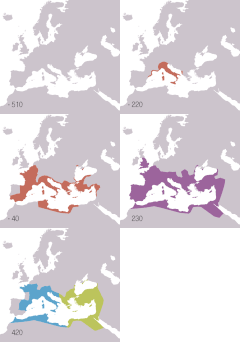
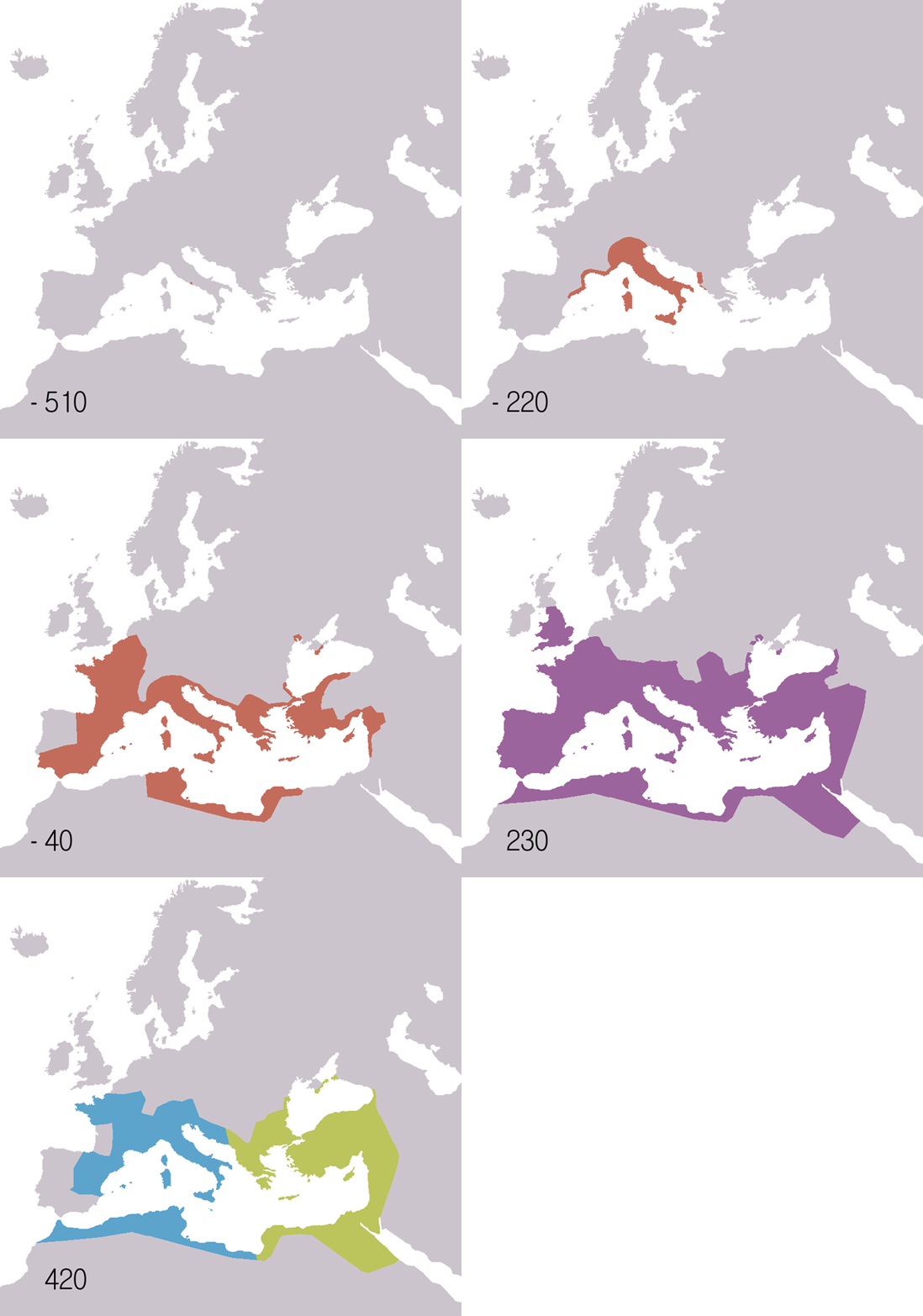
English: Animated map of the Roman Republic and Empire. Displayed in the map:
 
Roman republic 510BC-40BC
 
Roman Empire AD20-AD360
 
Eastern Roman Empire AD405-AD1453
 
Western Roman Empire AD405-AD480
Years shown: 510BC, 320BC, 300BC, 270BC, 220BC, 190BC, 140BC, 70BC, 40BC, AD20, AD70, AD140, AD230, AD300, AD360, AD405, AD420, AD450, AD480, AD530.
Español: Mapa animado de la República y el Imperio Romanos.
 
República Romana 510 a. C.-40 a. C.
 
Imperio Romano 20 d. C.-360 d. C.
 
Imperio Romano de Oriente 405 d. C.-1453 d. C.
Años mostrados en el mapa: 510 a. C., 320 a. C., 300 a. C., 270 a. C., 220 a. C., 190 a. C., 140 a. C., 70 a. C., 40 a. C., 20 d. C., 70 d. C., 140 d. C., 230 d. C., 300 d. C., 360 d. C., 405 d. C., 420 d. C., 450 d. C., 480 d. C., 530 d. C.
Français : Carte animée de la république puis de l'empire Romain.
 
République romaine : de -510 à -40.
 
Empire romain : de 20 à 360.
 
Empire romain d'Orient : de 405 à 1453.
 
Empire romain d'Occident : de 405 à 480.
Années montrées sur la carte : -510, -320, -300, -270, -220, -190, -140, -70, -40, 20, 70, 140, 230, 300, 360, 405, 420, 450, 480, 530.
Русский: Анимированные карты Римской республики и империи. Отображаются на карте:
 
Римская республика 510 до н.э. - 40 до н.э.
 
Римская империя 20 н.э. - 360 н.э.
Годы: 510 г. до н.э., 320 г. до н.э., 300 г. до н.э., 270 г. до н.э., 220 г. до н.э., 190 г. до н.э., 140 г. до н.э., 70 г. до н.э., 40 г. до н.э., 20 г. н.э., 70 г. н.э., 140 г. н.э., 230 г. н.э., 300 г. н.э., 360 г. н.э., 405 г. н.э., 420 г. н.э., 450 г. н.э., 480 г. н.э., 530 г. н.э..
日本語 共和政から帝政のローマ領の変遷。凡例:
 
共和政期 紀元前510年-40年
 
帝政期 20-360年
 
東ローマ帝国 405年-1453年
 
西ローマ帝国 405年-480年(テオドシウス朝と断絶)
年ごとの図: 紀元前510年、紀元前320年、紀元前300年、紀元前270年、紀元前220年、紀元前190年、紀元前140年、紀元前70年、紀元前40年、20年、70年、140年、230年、300年、360年、405年、420年、450年、480年、530年。
Dato
Fonto
English:
Español:
  • Mapa de base: Image:BlankMap-Europe-v3.png
  • Fuentes:
    • McEvedy, Colin. Penguin Atlas of Ancient History.
    • Haywood, John. Atlas of Past Times.
    • DK Atlas of world history
  • Véase también los siguientes mapas:
  • Français :
  • Fond de carte basé sur Image:BlankMap-Europe-v3.png
  • Source des données :
    • Colin McEvedy, Penguin Atlas of Ancient History
    • John Haywood, Atlas of Past Times
    • DK Atlas of world history
  • Voir aussi ces cartes :
  • 日本語
  • 背景地図はImage:BlankMap-Europe-v3.pngによる。
  • 出典:
    • McEvedy, Colin; John Woodcock (1988) The Penguin atlas of ancient history. Harmondsworth, Middlesex, England: Penguin Books
    • Haywood, John. (2002/2009) The atlas of past times. London: Brown Reference.
    • Black, Jeremy. DK Atlas of world history(ジェレミー・ブラック総監修『世界史アトラス』の原書)
    • 古代ローマの版図拡大図(地図) テキサス大学Perry-Castañeda Library収蔵
  • 外部リンク:
  • Autoro Roke (d)
    Altra versioni
    English: Version including the Byzantine Empire is at Image:Roman Empire map.gif.
    Español: Image:Roman Empire map.gif: versión que incluye al Imperio Bizantino.
    Français : Image:Roman Empire map.gif : version incluant l'empire byzantin.
    Русский: В том числе версия Византийской империи: Image:Roman Empire map.gif
    日本語 ビザンチン帝国を含む地図 : Image:Roman Empire map.gif
    Pozicio de la fotilo47° 00′ 00″ No, 18° 00′ 00″ Or  Heading=0° Kartographer map based on OpenStreetMap.Tiu cxi bildo kaj pliaj sur OpenStreetMapinfo

    Licencizo

    Me, la posedanto dil autoroyuro pri ica imajo/arkivo, permisos lua uzado camaniere:
    GNU head On darfas kopiigar, distributar ed/od altrigar ica dokumento segun la kondicioni di GNU Free Documentation License, quale esas mencionita en la versiono 1.2 od en irga plu posa versiono, qua esas publikigita da Free Software Foundation; En la dokumento ne darfas esas ne-altrigita parti ed olu ne darfas esar kom texto di frontala o dopala pagino di libro o GNU Free Documentation License.
    w:eo:Creative Commons
    Atribuo partigar identa ('share alike')
    Ica arkivo liberigesas sub permiso Creative Commons Attribution-Share Alike 3.0 Unported.
    Vu povas:
    • partigar – kopiar, distributar e transsendar la verko
    • Mixar – adaptar l'arkivo
    Segun la sequanta kondicioni:
    • Atribuo – Vu mustas referar l'artiklo o verko segun la formo definita dal autoro o dal proprietero dil autoroyuro, ed informar se modifikuri facesis. Vu mustas facar to per justa formo, ma ne insinuar ke l'autoro konfidis ol a vu, od aprobis vua uzo dil artiklo.
    • partigar identa ('share alike') – Se vu modifikos, transformos od augmentos ica verko, vu mustos distributar la rezulto segun la sama, o simila licenco, quale l'originalo.
    Ica etiketo pri uzo-permiso ligesis ad ica artiklo dum l'aktualigo dil yurizo GFDL.

    Titoloj

    Adjuntez 1 lineo explikanta quo reprezentas ca arkivo
    Animated map of the Roman Republic and Empire

    Kozi montrata en ca arkivo

    montras Esperanto

    sub kopirajto Esperanto

    6 jun. 2006

    MIME-tipo Esperanto

    image/gif

    kontrolsumo Esperanto

    a7c8c8f3ec123e0e7a45c6ef2d36670a25e83de8

    datena grando Esperanto

    103 367 Bicoko

    daŭro Esperanto

    37 sekundo

    alteco Esperanto

    595 Pixelo

    larĝeco Esperanto

    626 Pixelo

    47°0'0.000"N, 18°0'0.000"E

    heading angla: 0 grado

    Historio dil arkivo

    Kliktez sur la dato/horo por vidar arkivo quale ol aparis ye ta tempo.

    Dato/HoroMiniaturoDimensioniUzeroKomento
    aktuala19:14, 22 nov. 2009Imajeto di versiono ye 19:14, 22 nov. 2009626 × 595 (101 KB)SémhurAdding minus sign for BC years.
    09:56, 19 may. 2007Imajeto di versiono ye 09:56, 19 may. 2007626 × 595 (101 KB)Roke~commonswikiminor - colours of numbers off in last version
    07:31, 19 may. 2007Imajeto di versiono ye 07:31, 19 may. 2007626 × 595 (71 KB)Roke~commonswikifix area north of hadrians wall
    14:29, 2 jul. 2006Imajeto di versiono ye 14:29, 2 jul. 2006800 × 760 (218 KB)Roke~commonswikiReverted to earlier revision
    12:05, 6 jun. 2006Imajeto di versiono ye 12:05, 6 jun. 2006800 × 760 (218 KB)Roke~commonswikispeed up rate to 1 second
    10:58, 6 jun. 2006Imajeto di versiono ye 10:58, 6 jun. 2006800 × 760 (218 KB)Roke~commonswikimap of the Roman Empire based on Image:BlankMap-Europe-v3.png, displayed in the map: *Red = Roman republic 510BC-40BC *Purple = Roman Empire 20AD-360AD *Blue = Western Roman Empire 4

    Uzado en altra Wiki

    La sequanta Wiki anke uzas ica arkivo:

    Videz altra uzadi por ica artiklo.