
Arkivo:West Germany 1956-1990.svg

Grandezo di la previdado PNG de ica arkivo SVG: 450 x 456 pixels. Altra qualeso, en pixel-i: 237 x 240 pixels | 474 x 480 pixels | 758 x 768 pixels | 1 011 x 1 024 pixels | 2 021 x 2 048 pixels.
Arkivo originala (arkivo SVG, nominale 450 x 456 "pixels", kun 471 KB)
Titulo


.svg)
.svg)
.svg)
.svg)
.svg)


.svg)
.svg)
.svg)


.png)
.png)


.svg)


.svg)

.svg)


.svg)
.svg)
.svg)
.svg)


.svg)
.png)


.svg)


.svg)
.svg)


.svg)


.svg)


.svg)
.svg)
.svg)
.svg)
.svg)
.svg)
.svg)
_cropped.svg)
.svg)
.svg)
.svg)
.svg)
.svg)
.svg)
.svg)
.svg)
.svg)
.svg)
.svg)
.svg)
.svg)
.svg)
.svg)
.svg)
.svg)
.svg)
.svg)
.svg)
.svg)
.svg)
.svg)
.svg)
.svg)
.svg)
.svg)
.svg)
.svg)
.svg)
.svg)
.svg)
.svg)
.svg)
.svg)
.svg)
.svg)
.svg)
.svg)
.svg)
.svg)
.svg)
.svg)
.svg)
.svg)
| Ĉi tio estas modifita bildo, kio signifas, ke ĝi ekestis per cifereca aliigo de la origina versio. La originaĵo videblas ĉi tie: Blank map of Europe 1956-1990.svg.
|
Licencizo
Me, la posedanto dil autoroyuro pri ica imajo/arkivo, permisos lua uzado camaniere:
Ica arkivo liberigesas sub permiso Creative Commons Attribution-Share Alike 3.0 Unported.
- Vu povas:
- partigar – kopiar, distributar e transsendar la verko
- Mixar – adaptar l'arkivo
- Segun la sequanta kondicioni:
- Atribuo – Vu mustas referar l'artiklo o verko segun la formo definita dal autoro o dal proprietero dil autoroyuro, ed informar se modifikuri facesis. Vu mustas facar to per justa formo, ma ne insinuar ke l'autoro konfidis ol a vu, od aprobis vua uzo dil artiklo.
- partigar identa ('share alike') – Se vu modifikos, transformos od augmentos ica verko, vu mustos distributar la rezulto segun la sama, o simila licenco, quale l'originalo.
Originala protokolo dum sendado dil arkivo
This image is a derivative work of the following images:
- File:Blank_map_of_Europe_1956-1990.svg licensed with Cc-by-sa-3.0
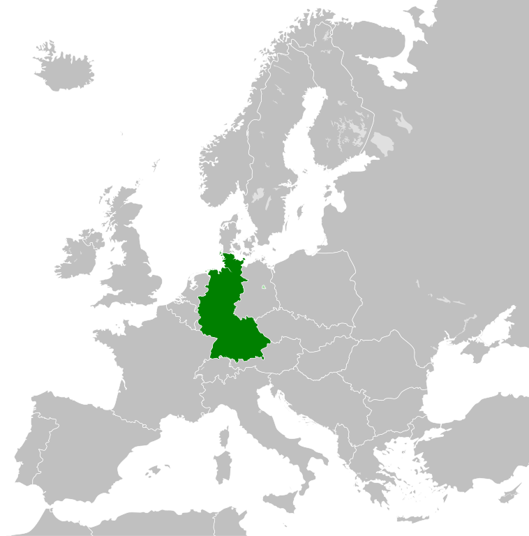
- 2011-10-30T04:43:42Z Alphathon 450x456 (485146 Bytes) == {{int:filedesc}} == {{Information |Description={{en|Blank map of Europe showing national borders as they stood from 1956-1990.}} |Source=*[[:File:Blank_map_of_Europe.svg|]] |Date=2011-10-30 04:42 (UTC) |Author=*[[:File:Bla
Historio dil arkivo
Kliktez sur la dato/horo por vidar arkivo quale ol aparis ye ta tempo.
| Dato/Horo | Miniaturo | Dimensioni | Uzero | Komento | |
|---|---|---|---|---|---|
| aktuala | 01:31, 28 sep. 2018 | | 450 × 456 (471 KB) | FelipeRev | Se incluye Berlín Oeste pero con un color diferente, para marcar que pertenecía a su espacio económico |
| 04:04, 15 jul. 2015 |  | 450 × 456 (476 KB) | Elevatorrailfan | Breaking apart West Germany and West Berlin paths. | |
| 01:43, 10 dec. 2014 |  | 450 × 456 (476 KB) | Elevatorrailfan | West Berlin was not part of West Germany. | |
| 00:39, 26 nov. 2011 |  | 450 × 456 (474 KB) | StalwartUK | == {{int:filedesc}} == {{Information |Description={{en|Map of West Germany (Federal Republic of Germany) as it was from 1949-1990. Surrounding countries accurate from 1956-1990.}} |Source=*[[:File:Blank_map_of_Europe_1956-1990.svg|Bla |
Ligilo al imajo
Ca pagini ligas al imajo:
Uzado en altra Wiki
La sequanta Wiki anke uzas ica arkivo:
- Uzado en af.wikipedia.org
- Uzado en an.wikipedia.org
- Uzado en ar.wikipedia.org
- Uzado en ast.wikipedia.org
- Uzado en be.wikipedia.org
- Uzado en bn.wikipedia.org
- Uzado en bs.wikipedia.org
- Uzado en ca.wikipedia.org
- Uzado en cs.wikipedia.org
- Uzado en da.wikipedia.org
- Uzado en el.wikipedia.org
- Uzado en en.wikipedia.org
- Uzado en eo.wikipedia.org
- Uzado en es.wikipedia.org
- Uzado en eu.wikipedia.org
- Uzado en fi.wikipedia.org
- Uzado en fr.wikipedia.org
- Uzado en fr.wiktionary.org
- Uzado en ga.wikipedia.org
- Uzado en gl.wikipedia.org
- Uzado en gv.wikipedia.org
- Uzado en ha.wikipedia.org
- Uzado en he.wikipedia.org
- Uzado en hi.wikipedia.org
- Uzado en hr.wikipedia.org
- Uzado en ia.wikipedia.org
- Uzado en id.wikipedia.org
- Uzado en it.wikipedia.org
- Uzado en ja.wikipedia.org
- Uzado en ka.wikipedia.org
- Uzado en ko.wikipedia.org
- Uzado en ku.wikipedia.org
- Uzado en lij.wikipedia.org
- Uzado en lld.wikipedia.org
- Uzado en lmo.wikipedia.org
- Uzado en lt.wikipedia.org
- Uzado en lv.wikipedia.org
- Uzado en mk.wikipedia.org
- Uzado en ml.wikipedia.org
- Uzado en mr.wikipedia.org
- Uzado en ms.wikipedia.org
- Uzado en nl.wikipedia.org
Videz altra uzadi por ica artiklo.