
Arkivo:Germany (+districts) location map.svg

Grandezo di la previdado PNG de ica arkivo SVG: 506 x 600 pixels. Altra qualeso, en pixel-i: 202 x 240 pixels | 405 x 480 pixels | 648 x 768 pixels | 864 x 1 024 pixels | 1 728 x 2 048 pixels | 1 073 x 1 272 pixels.
Arkivo originala (arkivo SVG, nominale 1 073 x 1 272 "pixels", kun 2,21 MB)
_location_map.svg)
Titulo
| Deskripto |
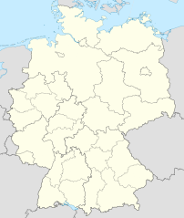
Deutsch: Positionskarte von Deutschland mit Grenzen der Regierungsbezirke und Landkreise
Quadratische Plattkarte, N-S-Streckung 150 %. Geographische Begrenzung der Karte:
English: Location map of Germany with waterbodies
Equirectangular projection, N/S stretching 150 %. Geographic limits of the map:
|
| Dato | |
| Fonto |
Propra verko Ĉi tiu W3C-neprecizigita dosiero estas kreita per Adobe Illustrator. Ĉu tiu dosiero estis alŝutita per Commonist.. This vector image includes elements that have been taken or adapted from this file: This vector image includes elements that have been taken or adapted from this file: |
| Autoro |
TUBS |
| Altra versioni |
_-_de_-_colored.svg) |
Licencizo
Me, la proprietero dil autoroyuri pri ica verko, per to publikigos ol segun la sequanta yurizi:
Ica arkivo liberigesas sub permiso Creative Commons Attribution-Share Alike 3.0 Unported.
- Vu povas:
- partigar – kopiar, distributar e transsendar la verko
- Mixar – adaptar l'arkivo
- Segun la sequanta kondicioni:
- Atribuo – Vu mustas referar l'artiklo o verko segun la formo definita dal autoro o dal proprietero dil autoroyuro, ed informar se modifikuri facesis. Vu mustas facar to per justa formo, ma ne insinuar ke l'autoro konfidis ol a vu, od aprobis vua uzo dil artiklo.
- partigar identa ('share alike') – Se vu modifikos, transformos od augmentos ica verko, vu mustos distributar la rezulto segun la sama, o simila licenco, quale l'originalo.

|
On darfas kopiigar, distributar ed/od altrigar ica dokumento segun la kondicioni di GNU Free Documentation License, quale esas mencionita en la versiono 1.2 od en irga plu posa versiono, qua esas publikigita da Free Software Foundation; En la dokumento ne darfas esas ne-altrigita parti ed olu ne darfas esar kom texto di frontala o dopala pagino di libro o GNU Free Documentation License. |
Selektez l'yurizo quon vu preferas.

|
I'd greatly appreciate, that you attribute this media file to Wikimedia Commons, if used outside Wikipedia or Commons. For use in publications such as books, newspapers, blogs, websites, please insert here the following line:
|
_location_map.svg)
Historio dil arkivo
Kliktez sur la dato/horo por vidar arkivo quale ol aparis ye ta tempo.
| Dato/Horo | Miniaturo | Dimensioni | Uzero | Komento | |
|---|---|---|---|---|---|
| aktuala | 12:40, 14 may. 2022 | | 1 073 × 1 272 (2,21 MB) | TUBS | erlangen + höchstadt - double borders |
| 12:18, 14 may. 2022 |  | 1 073 × 1 272 (4,18 MB) | TUBS | Reverted to version as of 09:22, 14 February 2020 (UTC): reverted. Did more harm than good (esp. concering islands in the Baltic and North See) and double/ghost borders. Will deal with the Franconian issue later. | |
| 08:49, 7 dec. 2021 |  | 1 073 × 1 272 (4,15 MB) | TUBS | erlangen + höchstadt vereint | |
| 09:22, 14 feb. 2020 |  | 1 073 × 1 272 (4,18 MB) | TUBS | pushed LK Kehlheim to the right Bezirk. ((This is not an update. Some districts have merged by now, e.g. Göttignen/Osterode. Some borders have changed as of February 2020. Don't have the time to redraw the map.) | |
| 13:01, 29 okt. 2013 |  | 1 073 × 1 272 (3,17 MB) | TUBS | ||
| 12:52, 29 okt. 2013 |  | 1 073 × 1 272 (1,61 MB) | TUBS | real loc map | |
| 18:44, 28 okt. 2013 |  | 1 073 × 1 272 (5,82 MB) | TUBS | == {{int:filedesc}} == {{Information |Description={{de|Karte der politischen Gliederung Deutschlands in Länder, Regierungsbezirke, Landkreise und krsfr. Städte}} {{en|Map of administrative divisions of Germany. States, government districts, districts... |
Ligilo al imajo
Nula pagino ligesas ad ica pagino.
Uzado en altra Wiki
La sequanta Wiki anke uzas ica arkivo:
- Uzado en de.wikipedia.org
_location_map.svg)