
Arkivo:Sulphur Tornado Radar Image.png
Grandeso de ica previdado: 800 x 394 pixels. Altra qualeso, en pixel-i: 320 x 158 pixels | 640 x 315 pixels | 1 024 x 505 pixels | 1 280 x 631 pixels | 2 322 x 1 144 pixels.
Arkivo originala (2 322 × 1 144 pixel-i, grandeso dil arkivo: 5,03 MB, MIME type: image/png)
Titulo
| Deskripto |
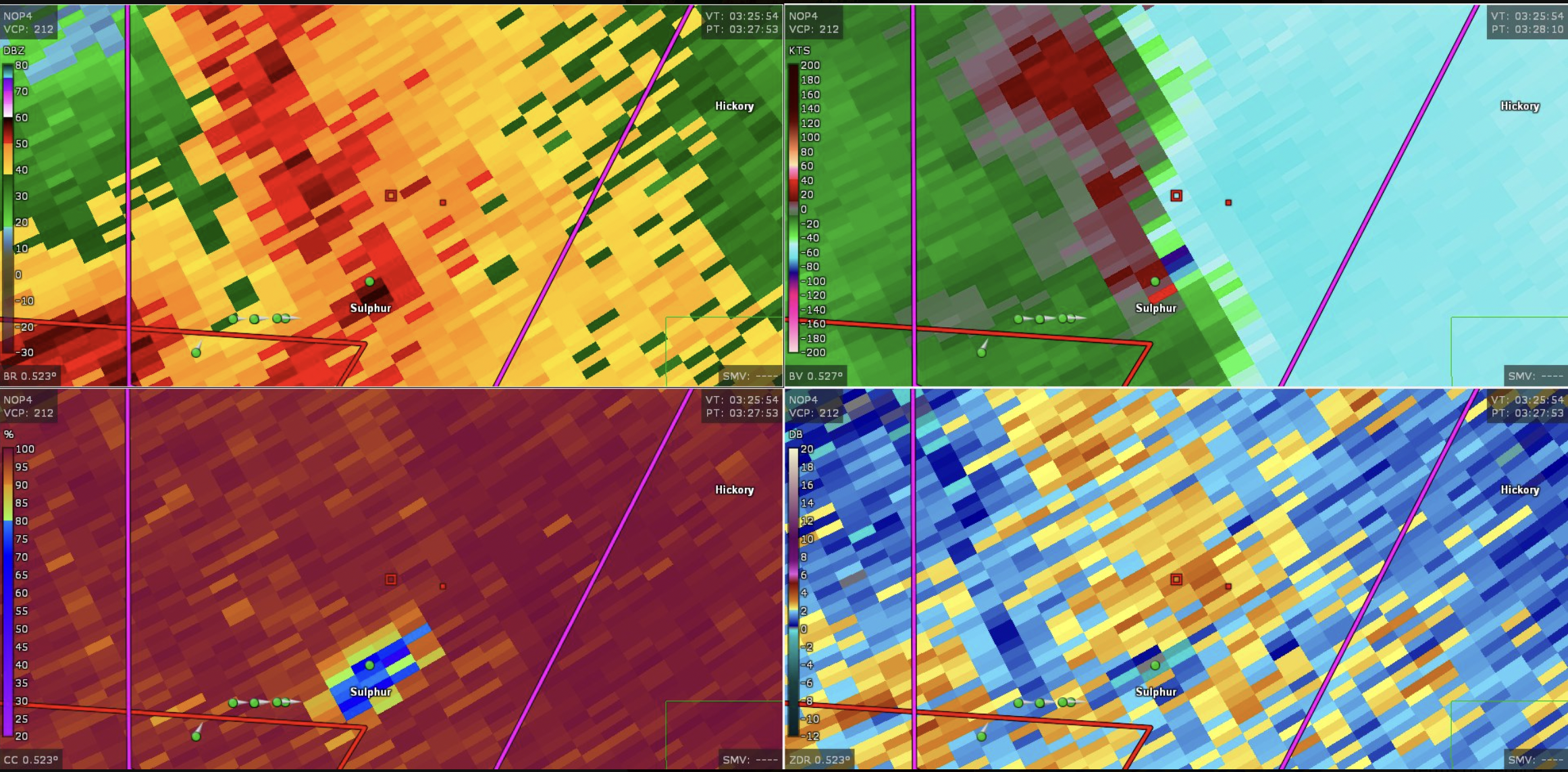
English: This image shows the radar presentation of a damaging tornado in Sulphu,r Oklahoma on April 27, 2024. |
| Dato | |
| Fonto | NEXRAD |
| Autoro | National Weather Service, Federal Aviation Administration, United States Air Force |
Licencizo
This image is in the public domain because it is from one or more of the U.S. government’s 159 NEXRAD radars, which are jointly owned and operated by the National Weather Service (NWS), an agency of the National Oceanic and Atmospheric Administration (NOAA) within the United States Department of Commerce, the Federal Aviation Administration (FAA) within the Department of Transportation, and the U.S. Air Force within the Department of Defense.
Thus all NEXRAD images are public domain.
|
  |
Historio dil arkivo
Kliktez sur la dato/horo por vidar arkivo quale ol aparis ye ta tempo.
| Dato/Horo | Miniaturo | Dimensioni | Uzero | Komento | |
|---|---|---|---|---|---|
| aktuala | 19:44, 28 apr. 2024 | | 2 322 × 1 144 (5,03 MB) | Floriangkmcc | Uploaded a work by The National Weather Service from Nexrad Radar with UploadWizard |
Ligilo al imajo
Nula pagino ligesas ad ica pagino.