
Arkivo:Strait of malacca.jpg
Ne existas grandeso plu granda.
Strait_of_malacca.jpg (717 × 478 pixel-i, grandeso dil arkivo: 252 KB, MIME type: image/jpeg)

|
Tiu ĉi bildo locator map respektive ĉiuj bildoj en tiu ĉi artikolo aŭ kategorio prefere estu rekreata(j) kiel vektora grafikaĵo en la formato SVG. Vektoraj formatoj por grafikaĵoj havas multajn avantaĝojn, detaloj troveblas anglalingve en la komuneja artikolo Commons:Media for cleanup. Se vi havas aŭ kreas SVG-version de tiu ĉi bildo, bonvolu alŝuti ĝin al la vikipedia komunejo. Post tiu ago, ĉi tiu ŝablono en la bildpaĝo estas anstataŭigenda per la ŝablono {{vector version available|nova dosiera nomo.svg}}.
|


Titulo
| Deskripto |
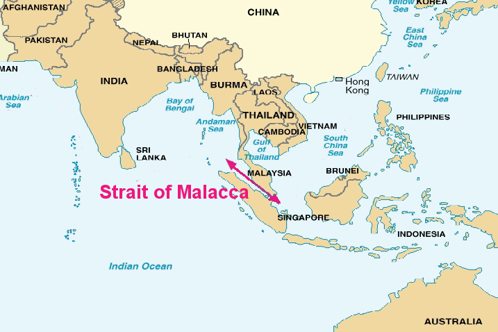
English: Map of the Strait of malacca, from a U.S. Department of Defense report. |
| Dato |
05/23/06 |
| Fonto | File:China Report 2006.pdf |
| Autoro | DoD |
Licencizo
This image is a work of a U.S. military or Department of Defense employee, taken or made as part of that person's official duties. As a work of the U.S. federal government, the image is in the public domain in the United States.
|
 |
Originala protokolo dum sendado dil arkivo
The original description page was here. All following user names refer to en.wikipedia.
Historio dil arkivo
Kliktez sur la dato/horo por vidar arkivo quale ol aparis ye ta tempo.
| Dato/Horo | Miniaturo | Dimensioni | Uzero | Komento | |
|---|---|---|---|---|---|
| aktuala | 03:09, 5 jan. 2011 | | 717 × 478 (252 KB) | File Upload Bot (Magnus Manske) | {{BotMoveToCommons|en.wikipedia|year={{subst:CURRENTYEAR}}|month={{subst:CURRENTMONTHNAME}}|day={{subst:CURRENTDAY}}}} {{Information |Description={{en|''no original description''}} |Source=Transferred from [http://en.wikipedia.org en.wikipedia]; transfer |
Ligilo al imajo
Ca pagini ligas al imajo:
Uzado en altra Wiki
La sequanta Wiki anke uzas ica arkivo:
- Uzado en bn.wikipedia.org
- Uzado en bs.wikipedia.org
- Uzado en ca.wikipedia.org
- Uzado en ckb.wikipedia.org
- Uzado en cs.wikipedia.org
- Uzado en da.wikipedia.org
- Uzado en el.wikipedia.org
- Uzado en en.wikipedia.org
- Uzado en en.wiktionary.org
- Uzado en eo.wikipedia.org
- Uzado en es.wikipedia.org
- Uzado en et.wikipedia.org
- Uzado en fa.wikipedia.org
- Uzado en fi.wikipedia.org
- Uzado en fo.wikipedia.org
- Uzado en fr.wikipedia.org
- Uzado en hak.wikipedia.org
- Uzado en id.wikipedia.org
- Uzado en is.wikipedia.org
- Uzado en it.wikipedia.org
- Uzado en ja.wikipedia.org
- Uzado en ko.wikipedia.org
- Uzado en ky.wikipedia.org
- Uzado en ms.wikipedia.org
- Uzado en pa.wikipedia.org
- Uzado en pt.wikipedia.org
- Uzado en ru.wikipedia.org
- Uzado en sr.wikipedia.org
- Uzado en sv.wikipedia.org
- Uzado en ta.wikipedia.org
- Uzado en te.wikipedia.org
- Uzado en uz.wikipedia.org
- Uzado en www.wikidata.org
- Uzado en zh-classical.wikipedia.org
- Uzado en zh.wikipedia.org
- Uzado en zh.wiktionary.org