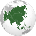
Arkivo:Asia (orthographic projection).svg

Grandezo di la previdado PNG de ica arkivo SVG: 541 x 541 pixels. Altra qualeso, en pixel-i: 240 x 240 pixels | 480 x 480 pixels | 768 x 768 pixels | 1 024 x 1 024 pixels | 2 048 x 2 048 pixels.
Arkivo originala (arkivo SVG, nominale 541 x 541 "pixels", kun 557 KB)
Historio dil arkivo
Kliktez sur la dato/horo por vidar arkivo quale ol aparis ye ta tempo.
| Dato/Horo | Miniaturo | Dimensioni | Uzero | Komento | |
|---|---|---|---|---|---|
| aktuala | 18:11, 29 jul. 2023 |  | 541 × 541 (557 KB) | Bennylin | synchronize with File:Southeast Asia (orthographic projection).svg. Source: File:United Nations geographical subregions.png |
| 00:57, 18 mar. 2023 |  | 541 × 541 (496 KB) | Golden Mage | A change to the map of Asia will first face debate from others. Hence, a change to the commonly accepted map of Oceania cannot be made without a wider consensus. | |
| 03:44, 17 mar. 2023 |  | 541 × 541 (557 KB) | Kwamikagami | the Weber line divides Asian from Oceanic Wallacea | |
| 19:29, 4 sep. 2022 |  | 541 × 541 (496 KB) | Рагин1987 | Socotra repainted | |
| 17:20, 4 sep. 2022 |  | 541 × 541 (492 KB) | Рагин1987 | Final edit | |
| 12:43, 4 sep. 2022 |  | 541 × 541 (446 KB) | Рагин1987 | Correction | |
| 13:13, 31 di agosto. 2022 |  | 2 048 × 2 048 (1,04 MB) | Рагин1987 | Small correction (Socotra Island is geologically closer to Africa) | |
| 17:59, 13 dec. 2019 |  | 541 × 541 (242 KB) | Goran tek-en | Added border for South Sudan as requested by {{u|Maphobbyist}} | |
| 10:16, 13 feb. 2019 |  | 541 × 541 (161 KB) | عبد الله | Reverted to version as of 16:47, 19 September 2016 (UTC) | |
| 10:11, 13 feb. 2019 |  | 512 × 512 (120 KB) | عبد الله | إزاة خطوط زعجة |
Ligilo al imajo
Ca pagini ligas al imajo:
- Afganistan
- Azerbaijan
- Bahrain
- Bangladesh
- Bhutan
- Brunei
- Estal Timor
- Filipini
- Historio di Afganistan
- Historio di Bahrain
- Historio di Bangladesh
- Historio di Brunei
- Historio di Butan
- Historio di Chinia
- Historio di Estal Timor
- Historio di Filipini
- Historio di India
- Historio di Indonezia
- Historio di Irak
- Historio di Iran
- Historio di Japonia
- Historio di Jordania
- Historio di Kambodja
- Historio di Katar
- Historio di Kazakstan
- Historio di Kirgizistan
- Historio di Kuwait
- Historio di Laos
- Historio di Libano
- Historio di Malaizia
- Historio di Maldivi
- Historio di Mongolia
- Historio di Myanmar
- Historio di Nepal
- Historio di Nord-Korea
- Historio di Oman
- Historio di Pakistan
- Historio di Republiko Chinia
- Historio di Saudi-Arabia
- Historio di Singapur
- Historio di Siria
- Historio di Sri-Lanka
- Historio di Sud-Korea
- Historio di Tailando
- Historio di Tajikistan
- Historio di Turkmenistan
- Historio di Unionita Araba Emirii
- Historio di Uzbekistan
- Historio di Vietnam
- Historio di Yemen
- India
- Indonezia
- Insulo Christmas
- Irak
- Iran
- Israel
- Japonia
- Jordania
- Kambodja
- Katar
- Kazakstan
- Kirgizistan
- Kuwait
- Laos
- Libano
- Malaizia
- Maldivi
- Mongolia
- Myanmar
- Nepal
- Nord-Korea
- Oman
- Pakistan
- Popul-Republiko Chinia
- Republiko Chinia
- Saudi-Arabia
- Singapur
- Siria
- Sri-Lanka
- Sud-Korea
- Tailando
- Tajikistan
- Turkia
- Turkmenistan
- Unionita Araba Emirii
- Uzbekistan
- Vietnam
- Yemen
- Shablono:Historio di Azia
- Shablono:Landi en Azia
Uzado en altra Wiki
La sequanta Wiki anke uzas ica arkivo:
- Uzado en ab.wikipedia.org
- Uzado en ace.wikipedia.org
- Uzado en ady.wikipedia.org
- Uzado en af.wikipedia.org
- Afrika
- Asië
- Europa
- Filippyne
- Irak
- Israel
- Japan
- Noord-Amerika
- Suid-Amerika
- Volksrepubliek China
- Thailand
- Singapoer
- Maleisië
- Afghanistan
- Sjabloon:Kontinente
- Bangkok
- Katar
- Taipei
- Indië
- Rusland
- Oesbekistan
- Hoofstad
- Lys van hoofstede
- Siprus
- Armenië
- Sjabloon:Lande van Asië
- Iran
- Egipte
- Wikipedia:Sjabloon
- Turkmenistan
- Wikipedia:Lys van sjablone
- Britse Indiese Oseaangebied
- Suid-Korea
- Noord-Korea
- Antarktika
- Beijing
- Gondwana
- Eurasië
- Laurasië
- Kategorie:Lande in Asië
- Libanon
- Jerusalem
- Azerbeidjan
- Bahrein
Videz altra uzadi por ica artiklo.


